Kirker i Aarhus Kommune: Forskelle mellem versioner
Fra AarhusWiki
Thorup (diskussion | bidrag) No edit summary |
Thorup (diskussion | bidrag) No edit summary |
||
| Linje 427: | Linje 427: | ||
"properties": { | "properties": { | ||
"title": "[[Kolt Kirke]]", | "title": "[[Kolt Kirke]]", | ||
"description": "[[ | "description": "[[Fil:Kolt Kirke 1957, Børge Andre Venge.jpg|200px]]", | ||
"marker-symbol": "religious-christian", | "marker-symbol": "religious-christian", | ||
"marker-size": "medium", | "marker-size": "medium", | ||
Versionen fra 16. sep. 2019, 12:29
Oversigtskort - Kirker i Aarhus <mapframe text="Træk i kortet for at se kirker uden for den centrale del af Aarhus." width=850 height=650 zoom=13 latitude=56.154939 longitude=10.193927 align=center> {
"type": "FeatureCollection",
"features": [
{
"type": "Feature",
"geometry": { "type": "Point", "coordinates": [10.210567, 56.156916] },
"properties": {
"title": "Aarhus Domkirke",
"description": "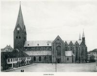 ",
"marker-symbol": "religious-christian",
"marker-size": "medium",
"marker-color": "0050d0"
}
},
{
"type": "Feature",
"geometry": { "type": "Point", "coordinates": [10.206814, 56.160055] },
"properties": {
"title": "Apostolsk Kirke",
"description": "
",
"marker-symbol": "religious-christian",
"marker-size": "medium",
"marker-color": "0050d0"
}
},
{
"type": "Feature",
"geometry": { "type": "Point", "coordinates": [10.206814, 56.160055] },
"properties": {
"title": "Apostolsk Kirke",
"description": " ",
"marker-symbol": "religious-christian",
"marker-size": "medium",
"marker-color": "0050d0"
}
},
",
"marker-symbol": "religious-christian",
"marker-size": "medium",
"marker-color": "0050d0"
}
},


{
"type": "Feature",
"geometry": { "type": "Point", "coordinates": [10.195584, 56.177663] },
"properties": {
"title": "Christianskirken",
"description": " ",
"marker-symbol": "religious-christian",
"marker-size": "medium",
"marker-color": "0050d0"
}
},
",
"marker-symbol": "religious-christian",
"marker-size": "medium",
"marker-color": "0050d0"
}
},

{
"type": "Feature",
"geometry": { "type": "Point", "coordinates": [10.101424, 56.151845] },
"properties": {
"title": "Brabrand Kirke",
"description": " ",
"marker-symbol": "religious-christian",
"marker-size": "medium",
"marker-color": "0050d0"
}
},
",
"marker-symbol": "religious-christian",
"marker-size": "medium",
"marker-color": "0050d0"
}
},

{
     "type": "Feature",
     "geometry": { "type": "Point", "coordinates": [10.133946, 56.155774] },
     "properties": {
       "title": "Gellerup Kirke",
       "description": "",
       "marker-symbol": "religious-christian",
       "marker-size": "medium",
      "marker-color": "0050d0"
     }
   },
{
     "type": "Feature",
     "geometry": { "type": "Point", "coordinates": [10.174450, 56.114290] },
     "properties": {
       "title": "Holme Kirke",
       "description": "",
       "marker-symbol": "religious-christian",
       "marker-size": "medium",
      "marker-color": "0050d0"
     }
   },
{
"type": "Feature",
"geometry": { "type": "Point", "coordinates": [10.204440, 56.151540] },
"properties": {
"title": "Katolsk Vor Frue Kirke",
"description": " ",
"marker-symbol": "religious-christian",
"marker-size": "medium",
"marker-color": "0050d0"
}
},
",
"marker-symbol": "religious-christian",
"marker-size": "medium",
"marker-color": "0050d0"
}
},

{
     "type": "Feature",
     "geometry": { "type": "Point", "coordinates": [10.194528, 56.039659] },
     "properties": {
       "title": "Malling Kirke",
       "description": "",
       "marker-symbol": "religious-christian",
       "marker-size": "medium",
      "marker-color": "0050d0"
     }
   },
{
"type": "Feature",
"geometry": { "type": "Point", "coordinates": [10.182620, 56.165751] },
"properties": {
"title": "Møllevangskirken",
"description": " ",
"marker-symbol": "religious-christian",
"marker-size": "medium",
"marker-color": "0050d0"
}
},
",
"marker-symbol": "religious-christian",
"marker-size": "medium",
"marker-color": "0050d0"
}
},

{
"type": "Feature",
"geometry": { "type": "Point", "coordinates": [10.203960, 56.146150] },
"properties": {
"title": "Sct. Pauls Kirke",
"description": " ",
"marker-symbol": "religious-christian",
"marker-size": "medium",
"marker-color": "0050d0"
}
},
",
"marker-symbol": "religious-christian",
"marker-size": "medium",
"marker-color": "0050d0"
}
},

{
"type": "Feature",
"geometry": { "type": "Point", "coordinates": [10.210169, 56.169155] },
"properties": {
"title": "Skt. Johannes Kirke",
"description": " ",
"marker-symbol": "religious-christian",
"marker-size": "medium",
"marker-color": "0050d0"
}
},
",
"marker-symbol": "religious-christian",
"marker-size": "medium",
"marker-color": "0050d0"
}
},

{
"type": "Feature",
"geometry": { "type": "Point", "coordinates": [10.193923, 56.144788] },
"properties": {
"title": "Skt. Lukas Kirke",
"description": " ",
"marker-symbol": "religious-christian",
"marker-size": "medium",
"marker-color": "0050d0"
}
},
",
"marker-symbol": "religious-christian",
"marker-size": "medium",
"marker-color": "0050d0"
}
},

{
"type": "Feature",
"geometry": { "type": "Point", "coordinates": [10.197655, 56.160850] },
"properties": {
"title": "Skt. Markus Kirke",
"description": " ",
"marker-symbol": "religious-christian",
"marker-size": "medium",
"marker-color": "0050d0"
}
},
",
"marker-symbol": "religious-christian",
"marker-size": "medium",
"marker-color": "0050d0"
}
},

{
"type": "Feature",
"geometry": { "type": "Point", "coordinates": [10.200214, 56.150914] },
"properties": {
"title": "Skt. Nikolajs Kirke",
"description": " ",
"marker-symbol": "religious-christian",
"marker-size": "medium",
"marker-color": "0050d0"
}
},
",
"marker-symbol": "religious-christian",
"marker-size": "medium",
"marker-color": "0050d0"
}
},

{
"type": "Feature",
"geometry": { "type": "Point", "coordinates": [10.213044, 56.158357] },
"properties": {
"title": "Skt. Olufs Kirke",
"description": " ",
"marker-symbol": "religious-christian",
"marker-size": "medium",
"marker-color": "0050d0"
}
},
",
"marker-symbol": "religious-christian",
"marker-size": "medium",
"marker-color": "0050d0"
}
},

{
"type": "Feature",
"geometry": { "type": "Point", "coordinates": [10.165708, 56.128211] },
"properties": {
"title": "Viby Kirke",
"description": " ",
"marker-symbol": "religious-christian",
"marker-size": "medium",
"marker-color": "0050d0"
}
},
",
"marker-symbol": "religious-christian",
"marker-size": "medium",
"marker-color": "0050d0"
}
},

{
"type": "Feature",
"geometry": { "type": "Point", "coordinates": [10.204861, 56.158106] },
"properties": {
"title": "Vor Frue Kirke",
"description": " ",
"marker-symbol": "religious-christian",
"marker-size": "medium",
"marker-color": "0050d0"
}
},
",
"marker-symbol": "religious-christian",
"marker-size": "medium",
"marker-color": "0050d0"
}
},

{
"type": "Feature",
"geometry": { "type": "Point", "coordinates": [10.157309, 56.155116] },
"properties": {
"title": "Åbyhøj Kirke",
"description": " ",
"marker-symbol": "religious-christian",
"marker-size": "medium",
"marker-color": "0050d0"
}
},
",
"marker-symbol": "religious-christian",
"marker-size": "medium",
"marker-color": "0050d0"
}
},

{
     "type": "Feature",
     "geometry": { "type": "Point", "coordinates": [10.162327, 56.145637] },
     "properties": {
       "title": "Gl. Åby Kirke",
       "description": "",
       "marker-symbol": "religious-christian",
       "marker-size": "medium",
      "marker-color": "0050d0"
     }
   },
{
     "type": "Feature",
     "geometry": { "type": "Point", "coordinates": [10.187247, 56.109285] },
     "properties": {
       "title": "Lyseng Kirke",
       "description": "",
       "marker-symbol": "religious-christian",
       "marker-size": "medium",
      "marker-color": "0050d0"
     }
   },
{
     "type": "Feature",
     "geometry": { "type": "Point", "coordinates": [10.183557, 56.129223] },
     "properties": {
       "title": "Fredenskirken",
       "description": "",
       "marker-symbol": "religious-christian",
       "marker-size": "medium",
      "marker-color": "0050d0"
     }
   },
{
"type": "Feature",
"geometry": { "type": "Point", "coordinates": [10.178386, 56.141008] },
"properties": {
"title": "Langenæskirken",
"description": " ",
"marker-symbol": "religious-christian",
"marker-size": "medium",
"marker-color": "0050d0"
}
},
",
"marker-symbol": "religious-christian",
"marker-size": "medium",
"marker-color": "0050d0"
}
},

{
"type": "Feature",
"geometry": { "type": "Point", "coordinates": [10.202141, 56.160957] },
"properties": {
"title": "Betlehemskirken",
"description": "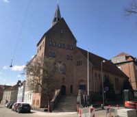 ",
"marker-symbol": "religious-christian",
"marker-size": "medium",
"marker-color": "0050d0"
}
},
",
"marker-symbol": "religious-christian",
"marker-size": "medium",
"marker-color": "0050d0"
}
},

{
"type": "Feature",
"geometry": { "type": "Point", "coordinates": [10.236320, 56.188192] },
"properties": {
"title": "Risskov Kirke",
"description": " ",
"marker-symbol": "religious-christian",
"marker-size": "medium",
"marker-color": "0050d0"
}
},
",
"marker-symbol": "religious-christian",
"marker-size": "medium",
"marker-color": "0050d0"
}
},

{
     "type": "Feature",
     "geometry": { "type": "Point", "coordinates": [10.194848, 56.192284] },
     "properties": {
       "title": "Skelager Kirke",
       "description": "",
       "marker-symbol": "religious-christian",
       "marker-size": "medium",
      "marker-color": "0050d0"
     }
   },
{
"type": "Feature",
"geometry": { "type": "Point", "coordinates": [10.174678, 56.199871] },
"properties": {
"title": "Skejby Kirke",
"description": "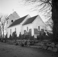 ",
"marker-symbol": "religious-christian",
"marker-size": "medium",
"marker-color": "0050d0"
}
},
",
"marker-symbol": "religious-christian",
"marker-size": "medium",
"marker-color": "0050d0"
}
},

{
"type": "Feature",
"geometry": { "type": "Point", "coordinates": [10.211815, 56.195161] },
"properties": {
"title": "Vejlby Kirke",
"description": " ",
"marker-symbol": "religious-christian",
"marker-size": "medium",
"marker-color": "0050d0"
}
},
",
"marker-symbol": "religious-christian",
"marker-size": "medium",
"marker-color": "0050d0"
}
},

{
"type": "Feature",
"geometry": { "type": "Point", "coordinates": [10.217810, 56.202135] },
"properties": {
"title": "Ellevang Kirke",
"description": "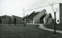 ",
"marker-symbol": "religious-christian",
"marker-size": "medium",
"marker-color": "0050d0"
}
},
",
"marker-symbol": "religious-christian",
"marker-size": "medium",
"marker-color": "0050d0"
}
},

{
"type": "Feature",
"geometry": { "type": "Point", "coordinates": [10.265325, 56.216576] },
"properties": {
"title": "Egå Kirke",
"description": "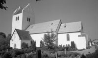 ",
"marker-symbol": "religious-christian",
"marker-size": "medium",
"marker-color": "0050d0"
}
},
",
"marker-symbol": "religious-christian",
"marker-size": "medium",
"marker-color": "0050d0"
}
},

{
     "type": "Feature",
     "geometry": { "type": "Point", "coordinates": [10.304557, 56.234084] },
     "properties": {
       "title": "Skæring Kirke",
       "description": "",
       "marker-symbol": "religious-christian",
       "marker-size": "medium",
      "marker-color": "0050d0"
     }
   },
{
     "type": "Feature",
     "geometry": { "type": "Point", "coordinates": [10.234103, 56.235499] },
     "properties": {
       "title": "Lystrup Kirke",
       "description": "",
       "marker-symbol": "religious-christian",
       "marker-size": "medium",
      "marker-color": "0050d0"
     }
   },
{
     "type": "Feature",
     "geometry": { "type": "Point", "coordinates": [10.167629, 56.180254] },
     "properties": {
       "title": "Helligåndskirken",
       "description": "",
       "marker-symbol": "religious-christian",
       "marker-size": "medium",
      "marker-color": "0050d0"
     }
   },
{
"type": "Feature",
"geometry": { "type": "Point", "coordinates": [10.161186, 56.169720] },
"properties": {
"title": "Hasle Kirke",
"description": "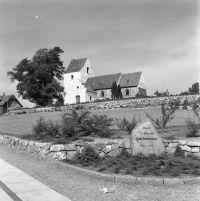 ",
"marker-symbol": "religious-christian",
"marker-size": "medium",
"marker-color": "0050d0"
}
},
",
"marker-symbol": "religious-christian",
"marker-size": "medium",
"marker-color": "0050d0"
}
},

{
     "type": "Feature",
     "geometry": { "type": "Point", "coordinates": [10.159854, 56.169126] },
     "properties": {
       "title": "Citykirken",
       "description": "",
       "marker-symbol": "religious-christian",
       "marker-size": "medium",
      "marker-color": "0050d0"
     }
   },
{
     "type": "Feature",
     "geometry": { "type": "Point", "coordinates": [10.186631, 56.165249] },
     "properties": {
       "title": "Aarhus Adventistkirke",
       "description": "",
       "marker-symbol": "religious-christian",
       "marker-size": "medium",
      "marker-color": "0050d0"
     }
   },
{
     "type": "Feature",
     "geometry": { "type": "Point", "coordinates": [10.187228, 56.108544] },
     "properties": {
       "title": "Saralystkirken",
       "description": "",
       "marker-symbol": "religious-christian",
       "marker-size": "medium",
      "marker-color": "0050d0"
     }
   },
{
     "type": "Feature",
     "geometry": { "type": "Point", "coordinates": [10.142631, 56.122670] },
     "properties": {
       "title": "Ravnsbjergkirken",
       "description": "",
       "marker-symbol": "religious-christian",
       "marker-size": "medium",
      "marker-color": "0050d0"
     }
   },
{
"type": "Feature",
"geometry": { "type": "Point", "coordinates": [10.060490, 56.124771] },
"properties": {
"title": "Ormslev Kirke",
"description": "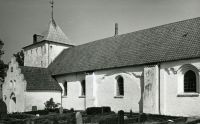 ",
"marker-symbol": "religious-christian",
"marker-size": "medium",
"marker-color": "0050d0"
}
},
",
"marker-symbol": "religious-christian",
"marker-size": "medium",
"marker-color": "0050d0"
}
},

{
"type": "Feature",
"geometry": { "type": "Point", "coordinates": [10.070924, 56.109365] },
"properties": {
"title": "Kolt Kirke",
"description": " ",
"marker-symbol": "religious-christian",
"marker-size": "medium",
"marker-color": "0050d0"
}
},
",
"marker-symbol": "religious-christian",
"marker-size": "medium",
"marker-color": "0050d0"
}
},

{
     "type": "Feature",
     "geometry": { "type": "Point", "coordinates": [10.061819, 56.103109] },
     "properties": {
       "title": "Bering Valgmenighedskirke",
       "description": "",
       "marker-symbol": "religious-christian",
       "marker-size": "medium",
      "marker-color": "0050d0"
     }
   },
{
"type": "Feature",
"geometry": { "type": "Point", "coordinates": [10.134896, 56.091936] },
"properties": {
"title": "Tranbjerg Kirke",
"description": " ",
"marker-symbol": "religious-christian",
"marker-size": "medium",
"marker-color": "0050d0"
}
},
",
"marker-symbol": "religious-christian",
"marker-size": "medium",
"marker-color": "0050d0"
}
},

{
     "type": "Feature",
     "geometry": { "type": "Point", "coordinates": [10.160336, 56.067683] },
     "properties": {
       "title": "Mårslet Kirke",
       "description": "",
       "marker-symbol": "religious-christian",
       "marker-size": "medium",
      "marker-color": "0050d0"
     }
   },
{
     "type": "Feature",
     "geometry": { "type": "Point", "coordinates": [10.216597, 56.059696] },
     "properties": {
       "title": "Beder Kirke",
       "description": "",
       "marker-symbol": "religious-christian",
       "marker-size": "medium",
      "marker-color": "0050d0"
     }
   },
{
     "type": "Feature",
     "geometry": { "type": "Point", "coordinates": [10.200351, 56.195000] },
     "properties": {
       "title": "Gratiakirken",
       "description": "",
       "marker-symbol": "religious-christian",
       "marker-size": "medium",
      "marker-color": "0050d0"
     }
   },
{
     "type": "Feature",
     "geometry": { "type": "Point", "coordinates": [10.131103, 56.209083] },
     "properties": {
       "title": "Kasted Kirke",
       "description": "",
       "marker-symbol": "religious-christian",
       "marker-size": "medium",
      "marker-color": "0050d0"
     }
   },
{
     "type": "Feature",
     "geometry": { "type": "Point", "coordinates": [10.122228, 56.174064] },
     "properties": {
       "title": "Skjoldhøj Kirke",
       "description": "",
       "marker-symbol": "religious-christian",
       "marker-size": "medium",
      "marker-color": "0050d0"
     }
   },
{
"type": "Feature",
"geometry": { "type": "Point", "coordinates": [10.111325, 56.192993] },
"properties": {
"title": "Tilst Kirke",
"description": " ",
"marker-symbol": "religious-christian",
"marker-size": "medium",
"marker-color": "0050d0"
}
},
",
"marker-symbol": "religious-christian",
"marker-size": "medium",
"marker-color": "0050d0"
}
},

{
     "type": "Feature",
     "geometry": { "type": "Point", "coordinates": [10.070082, 56.209769] },
     "properties": {
       "title": "Fårup Kirke",
       "description": "",
       "marker-symbol": "religious-christian",
       "marker-size": "medium",
      "marker-color": "0050d0"
     }
   },
{
     "type": "Feature",
     "geometry": { "type": "Point", "coordinates": [10.168546, 56.221356] },
     "properties": {
       "title": "Lisbjerg Kirke",
       "description": "",
       "marker-symbol": "religious-christian",
       "marker-size": "medium",
      "marker-color": "0050d0"
     }
   },
{
"type": "Feature",
"geometry": { "type": "Point", "coordinates": [10.197695, 56.241669] },
"properties": {
"title": "Elev Kirke",
"description": " ",
"marker-symbol": "religious-christian",
"marker-size": "medium",
"marker-color": "0050d0"
}
},
",
"marker-symbol": "religious-christian",
"marker-size": "medium",
"marker-color": "0050d0"
}
},

{
     "type": "Feature",
     "geometry": { "type": "Point", "coordinates": [10.265087, 56.252330] },
     "properties": {
       "title": "Hjortshøj Kirke",
       "description": "",
       "marker-symbol": "religious-christian",
       "marker-size": "medium",
      "marker-color": "0050d0"
     }
   },
{
"type": "Feature",
"geometry": { "type": "Point", "coordinates": [10.191578, 56.146311] },
"properties": {
"title": "Immanuelskirken (Aarhus Baptistkirke)",
"description": "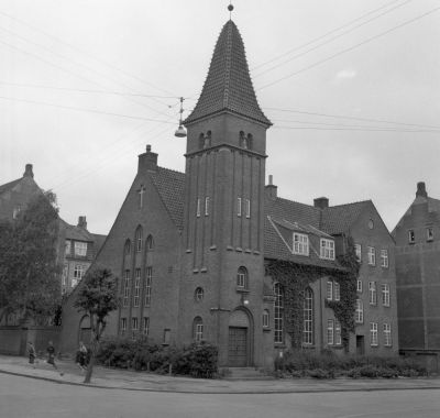 ",
"marker-symbol": "religious-christian",
"marker-size": "medium",
"marker-color": "0050d0"
}
},
",
"marker-symbol": "religious-christian",
"marker-size": "medium",
"marker-color": "0050d0"
}
},
_1970,_B%C3%B8rge_Andre_Venge.jpg)
{
     "type": "Feature",
     "geometry": { "type": "Point", "coordinates": [10.229123, 56.245646] },
     "properties": {
       "title": "Elsted Kirke",
       "description": "",
       "marker-symbol": "religious-christian",
       "marker-size": "medium",
      "marker-color": "0050d0"
     }
   },
{
     "type": "Feature",
     "geometry": { "type": "Point", "coordinates": [10.167833, 56.151585] },
     "properties": {
       "title": "Aarhus Valgmenighed",
       "description": "",
       "marker-symbol": "religious-christian",
       "marker-size": "medium",
      "marker-color": "0050d0"
     }
   }
 ]
} </mapframe>
Liste over kirker i Aarhus:
- Aarhus Domkirke på Store Torv
- Apostolsk Kirke på Nørre Allé
- Brabrand Kirke i Brabrand
- Christianskirken på Christiansbjerg
- Gellerup Kirke i Gellerup
- Holme Kirke i Holme
- Katolsk Vor Frue Kirke på Ryesgade
- Malling Kirke i Malling
- Møllevangskirken på hjørnet af Fuglebakkevej og Fuglesangsallé
- Sct. Pauls Kirke på Skt. Pauls Kirkeplads
- Skt. Johannes Kirke på Trøjborg
- Skt. Lukas Kirke på Ingerslevs Boulevard
- Skt. Markus Kirke på Skt. Markus Kirkeplads ved Langelandsgade
- Skt. Nicolai Domkirke – Aarhus tidligere domkirke. Det eneste der er tilbage er krypen under Vor Frue Kirke
- Skt. Nikolajs Kirke på Frederiks Allé 37
- Skt. Olufs Kirke lå på hjørnet af Sankt Olufs Gade og Skolebakken. Kirken styrtede sammen i 1548.
- Viby Kirke i Viby
- Vor Frue Kirke på Vestergade. Kirken er en del af Vor Frue Kloster