Villaer i 1800-tallets Aarhus (oversigtskort): Forskelle mellem versioner
Fra AarhusWiki
Lgk (diskussion | bidrag) mIngen redigeringsopsummering |
Lgk (diskussion | bidrag) mIngen redigeringsopsummering |
||
| Linje 233: | Linje 233: | ||
"marker-size": "medium", | "marker-size": "medium", | ||
"marker-color": "FF0000" | "marker-color": "FF0000" | ||
} | |||
}, | |||
{ | |||
"type": "Feature", | |||
"geometry": { "type": "Point", "coordinates": [10.211051, 56.164144] }, | |||
"properties": { | |||
"title": "[[Kirkegårdsvej 4]]", | |||
"description": "[[File:Apostolsk kirke noerre alle 1890-1900 hammerschmidt.jpg|175px]]", | |||
"marker-symbol": "building", | |||
"marker-size": "medium", | |||
"marker-color": "FF0000" | |||
} | |||
}, | |||
{ | |||
"type": "Feature", | |||
"geometry": { "type": "Point", "coordinates": [10.211195, 56.164254] }, | |||
"properties": { | |||
"title": "[[Kirkegårdsvej 6]]", | |||
"description": "[[File:Apostolsk kirke noerre alle 1890-1900 hammerschmidt.jpg|175px]]", | |||
"marker-symbol": "building", | |||
"marker-size": "medium", | |||
"marker-color": "FF0000" | |||
} | |||
}, | |||
{ | |||
"type": "Feature", | |||
"geometry": { "type": "Point", "coordinates": [10.211045, 56.164469] }, | |||
"properties": { | |||
"title": "[[Kirkegårdsvej 19]]", | |||
"description": "[[File:Apostolsk kirke noerre alle 1890-1900 hammerschmidt.jpg|175px]]", | |||
"marker-symbol": "building", | |||
"marker-size": "medium", | |||
"marker-color": "0050d0" | |||
} | } | ||
}, | }, | ||
Versionen fra 13. nov. 2019, 13:38
Oversigtskort - Villaer i Aarhus <mapframe text="Træk i kortet for at se villaer uden for den centrale del af Aarhus." width=850 height=650 zoom=14 latitude=56.160560 longitude=10.208859 align=center> {
"type": "FeatureCollection",
"features": [
{
"type": "Feature",
"geometry": { "type": "Point", "coordinates": [10.211010, 56.170370] },
"properties": {
"title": "Trøjborgvej 58-66, 'Villa Aldersro'",
"description": "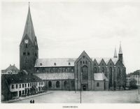 ",
"marker-symbol": "building",
"marker-size": "medium",
"marker-color": "FF0000"
}
},
",
"marker-symbol": "building",
"marker-size": "medium",
"marker-color": "FF0000"
}
},

{
"type": "Feature",
"geometry": { "type": "Point", "coordinates": [10.211157, 56.171383] },
"properties": {
"title": "Aldersrovej 21, 'Villa Granly'",
"description": " ",
"marker-symbol": "building",
"marker-size": "medium",
"marker-color": "0050d0"
}
},
",
"marker-symbol": "building",
"marker-size": "medium",
"marker-color": "0050d0"
}
},

{
     "type": "Feature",
     "geometry": { "type": "Point", "coordinates": [10.210879, 56.172022] },
     "properties": {
       "title": "Aldersrovej 27B, 'Villa Montana'",
       "description": "",
       "marker-symbol": "building",
       "marker-size": "medium",
      "marker-color": "0050d0"
     }
   },
{
     "type": "Feature",
     "geometry": { "type": "Point", "coordinates": [10.210809, 56.172199] },
     "properties": {
       "title": "Aldersrovej 29, 'Villa Dan'",
       "description": "",
       "marker-symbol": "building",
       "marker-size": "medium",
      "marker-color": "0050d0"
     }
   },
{
     "type": "Feature",
     "geometry": { "type": "Point", "coordinates": [10.210763, 56.172351] },
     "properties": {
       "title": "Aldersrovej 31, 'Villa Frem'",
       "description": "",
       "marker-symbol": "building",
       "marker-size": "medium",
      "marker-color": "0050d0"
     }
   },
{
     "type": "Feature",
     "geometry": { "type": "Point", "coordinates": [10.209500, 56.171076] },
     "properties": {
       "title": "Barthsgade 12",
       "description": "",
       "marker-symbol": "building",
       "marker-size": "medium",
      "marker-color": "FF0000"
     }
   },
{
     "type": "Feature",
     "geometry": { "type": "Point", "coordinates": [10.209221, 56.171488] },
     "properties": {
       "title": "Barthsgade 15, 'Villa Fredebo'",
       "description": "",
       "marker-symbol": "building",
       "marker-size": "medium",
      "marker-color": "0050d0"
     }
   },
{
     "type": "Feature",
     "geometry": { "type": "Point", "coordinates": [10.209848, 56.171803] },
     "properties": {
       "title": "Barthsgade 20, 'Villa Lindehøj'",
       "description": "",
       "marker-symbol": "building",
       "marker-size": "medium",
      "marker-color": "0050d0"
     }
   },
{
     "type": "Feature",
     "geometry": { "type": "Point", "coordinates": [10.209848, 56.171803] },
     "properties": {
       "title": "Dronning Margrethes Vej 4, 'Villa Trøjborg'",
       "description": "",
       "marker-symbol": "building",
       "marker-size": "medium",
      "marker-color": "FF0000"
     }
   },
{
     "type": "Feature",
     "geometry": { "type": "Point", "coordinates": [10.220021, 56.168792] },
     "properties": {
       "title": "Dronning Margrethes Vej 6, 'Villa Tårnborg'",
       "description": "",
       "marker-symbol": "building",
       "marker-size": "medium",
      "marker-color": "0050d0"
     }
   },
{
     "type": "Feature",
     "geometry": { "type": "Point", "coordinates": [10.220180, 56.169030] },
     "properties": {
       "title": "Dronning Margrethes Vej 8, 'Villa Riisbo'",
       "description": "",
       "marker-symbol": "building",
       "marker-size": "medium",
      "marker-color": "0050d0"
     }
   },
{
     "type": "Feature",
     "geometry": { "type": "Point", "coordinates": [10.219943, 56.169148] },
     "properties": {
       "title": "Dronning Margrethes Vej 10-12, 'Villa Tamina'",
       "description": "",
       "marker-symbol": "building",
       "marker-size": "medium",
      "marker-color": "0050d0"
     }
   },
{
     "type": "Feature",
     "geometry": { "type": "Point", "coordinates": [10.219545, 56.169152] },
     "properties": {
       "title": "Dronning Margrethes Vej 14, 'Villa Pax'",
       "description": "",
       "marker-symbol": "building",
       "marker-size": "medium",
      "marker-color": "0050d0"
     }
   },
{
     "type": "Feature",
     "geometry": { "type": "Point", "coordinates": [10.208084, 56.171939] },
     "properties": {
       "title": "Nordre Ringgade 58, 'Villa Solvænge'",
       "description": "",
       "marker-symbol": "building",
       "marker-size": "medium",
      "marker-color": "FF0000"
     }
   },
{
     "type": "Feature",
     "geometry": { "type": "Point", "coordinates": [10.210089, 56.172295] },
     "properties": {
       "title": "Nordre Ringgade 68, 'Villa Rosenvang'",
       "description": "",
       "marker-symbol": "building",
       "marker-size": "medium",
      "marker-color": "0050d0"
     }
   },
{
     "type": "Feature",
     "geometry": { "type": "Point", "coordinates": [10.210089, 56.172295] },
     "properties": {
       "title": "Nordre Ringgade 70, 'Villa Rødebøge'",
       "description": "",
       "marker-symbol": "building",
       "marker-size": "medium",
      "marker-color": "0050d0"
     }
   },
{
     "type": "Feature",
     "geometry": { "type": "Point", "coordinates": [10.219272, 56.168022] },
     "properties": {
       "title": "Skovvejen 46M, 'Villa Højbo'",
       "description": "",
       "marker-symbol": "building",
       "marker-size": "medium",
      "marker-color": "0050d0"
     }
   },
{
     "type": "Feature",
     "geometry": { "type": "Point", "coordinates": [10.219214, 56.168310] },
     "properties": {
       "title": "Skovvejen 46N, 'Villa Sunhill'",
       "description": "",
       "marker-symbol": "building",
       "marker-size": "medium",
      "marker-color": "0050d0"
     }
   },
{
     "type": "Feature",
     "geometry": { "type": "Point", "coordinates": [10.218414, 56.169141] },
     "properties": {
       "title": "Trøjborgvej 2D",
       "description": "",
       "marker-symbol": "building",
       "marker-size": "medium",
      "marker-color": "0050d0"
     }
   },
{
     "type": "Feature",
     "geometry": { "type": "Point", "coordinates": [10.209820, 56.170596] },
     "properties": {
       "title": "Trøjborgvej 74, 'Villa Fairhill'",
       "description": "",
       "marker-symbol": "building",
       "marker-size": "medium",
      "marker-color": "0050d0"
     }
   },
{
     "type": "Feature",
     "geometry": { "type": "Point", "coordinates": [10.210715, 56.163931] },
     "properties": {
       "title": "Kirkegårdsvej 2",
       "description": "",
       "marker-symbol": "building",
       "marker-size": "medium",
      "marker-color": "FF0000"
     }
   },
{
     "type": "Feature",
     "geometry": { "type": "Point", "coordinates": [10.211051, 56.164144] },
     "properties": {
       "title": "Kirkegårdsvej 4",
       "description": "",
       "marker-symbol": "building",
       "marker-size": "medium",
      "marker-color": "FF0000"
     }
   },
{
     "type": "Feature",
     "geometry": { "type": "Point", "coordinates": [10.211195, 56.164254] },
     "properties": {
       "title": "Kirkegårdsvej 6",
       "description": "",
       "marker-symbol": "building",
       "marker-size": "medium",
      "marker-color": "FF0000"
     }
   },
{
     "type": "Feature",
     "geometry": { "type": "Point", "coordinates": [10.211045, 56.164469] },
     "properties": {
       "title": "Kirkegårdsvej 19",
       "description": "",
       "marker-symbol": "building",
       "marker-size": "medium",
      "marker-color": "0050d0"
     }
   },
]
}
</mapframe>
